- Sustainability
- Accessability
- Destinations
Søndre Sandøy lies northeast of Herføl, with only the narrow Gravningsundet Sound separating it from Nordre Sandøy. To the east is Sekken, a narrow and exposed stretch of water that separates the island from the Swedish mainland. It is the largest of the eastern isles, with Svarteberget at 50 m its highest point. Søndre Sandøy has two ferry jetties, Nedgården in the west and Gravningsund at Buvika in the northeast. A fine gravel road connects these, but there are many other paths that will bring you to bathing spots on the east coast. The island has some dark woods with uneven terrain, but also beautiful countryside with lovely flower meadows.
Down the centuries there have been several periods of intense, but short-lived, herring fishing. In the decades before 1900 the fishing and processing of herring was a sizable industry, not least in Gravningsundet. We can still see the large red buildings on both sides of the sound that were part of the industry.
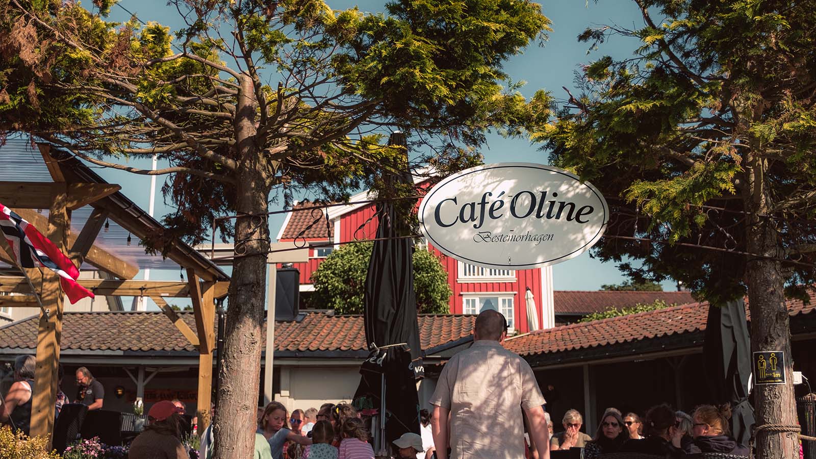
At Nedgården is Café Oline, with a pub, restaurant and entertainment all summer. It is a popular place – many ferry passengers going directly from the jetty to the café – but also an important component in keeping
Looking for a great beach? From the Gravningsund ferry jetty we follow Hjertestien (the Heart Trail) across the island and south to Gjøvika Bay. It is sheltered from wind, waves and boat traffic. Stretch out on the beach or on the polished granite rock to the south. There are rock formations for every body shape.
As a curiosity it is worth going round the southern promontory to Grøtvika. Here you will find a disused gneiss quarry from which the façade stone for Oslo City Hall was taken.
The Heart Trail can be followed onwards through undulating woods, and there are several paths leading off to the main road to Nedgården.
Kløverstien (the Clover Trail) follows easier terrain than Hjertestien. From Nedgården we walk east to the junction at Løkkeberg. From here we can continue east to Stuevika or take a round trip of the lovely countryside to the south. We can make a detour to Rødsbrygga, where a large Bronze Age cairn crowns the hill. It is intact and not dissimilar to the cairn on Herføl, only smaller – about 15 metres in diameter. For several thousand years it has been a navigation aid for seafarers. We can also make a detour to Gjølertangen Nature Reserve in the southeast, with its characteristic yew trees. Going north again we come to Stuevika Bay, with its long shallows.
Stuevika Camping Site, on the east coast, is run by the regional coastal authority. We camp on the beach – far from all traffic noise or the uproar of nightlife. Nor will we be woken early in the morning by suitcases trundling on cobblestones. No annoying waiters, we cook for ourselves or walk over to Café Oline at Nedgården. The children will be safe in the long shallows of the beach. It’s the ideal spot if you love the sun, but hate the stress of package tours.
 Norsk
Norsk